


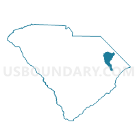
Nichols Voting District, Marion County, South Carolina
About
Outline

Summary
| Unique Area Identifier | 666367 |
| Name | Nichols Voting District |
| County | Marion County |
| State | South Carolina |
| Area (square miles) | 17.97 |
| Land Area (square miles) | 17.97 |
| Water Area (square miles) | 0.00 |
| % of Land Area | 100.00 |
| % of Water Area | 0.00 |
| Latitude of the Internal Point | 34.24205360 |
| Longtitude of the Internal Point | -79.16718250 |
Maps


Graphs
Select a template below for downloading or customizing gragh for Nichols Voting District, Marion County, South Carolina


Neighbors
Neighoring Voting District (by Name) Neighboring Voting District on the Map
- Floyds Voting District, Horry County, SC
- Fork Voting District, Dillon County, SC
- Kemper Voting District, Dillon County, SC
- Lake View Voting District, Dillon County, SC
- Northeast Mullins Voting District, Marion County, SC
- Southeast Mullins Voting District, Marion County, SC
- Spring Branch Voting District, Horry County, SC
Top 10 Neighboring County Subdivision (by Population) Neighboring County Subdivision on the Map
- Mullins CCD, Marion County, SC (11,861)
- Lake View CCD, Dillon County, SC (4,370)
- Floyds Crossroads CCD, Horry County, SC (3,301)
Top 10 Neighboring Place (by Population) Neighboring Place on the Map
Top 10 Neighboring Unified School District (by Population) Neighboring Unified School District on the Map
- Horry County School District, SC (269,291)
- Marion School District 2, SC (11,648)
- Dillon School District 1, SC (5,462)
Top 10 Neighboring State Legislative District Lower Chamber (by Population) Neighboring State Legislative District Lower Chamber on the Map
- State House District 58, SC (38,710)
- State House District 55, SC (34,048)
- State House District 57, SC (30,096)
Top 10 Neighboring State Legislative District Upper Chamber (by Population) Neighboring State Legislative District Upper Chamber on the Map
Top 10 Neighboring 111th Congressional District (by Population) Neighboring 111th Congressional District on the Map
- Congressional District 1, SC (856,956)
- Congressional District 5, SC (767,773)
- Congressional District 6, SC (682,410)
Top 10 Neighboring Census Tract (by Population) Neighboring Census Tract on the Map
- Census Tract 9505, Marion County, SC (4,891)
- Census Tract 9705, Dillon County, SC (4,370)
- Census Tract 9504, Marion County, SC (3,863)
- Census Tract 101, Horry County, SC (3,301)